About California Cooperative Snow Surveys (CCSS)
The annual snowpack in California's Sierra Nevada and Cascade mountain ranges is a vital freshwater reservoir, with an average annual capacity of over 13 million acre-feet. This snowpack accumulates during winter and gradually melts in spring and early summer, providing water for reservoirs, power generation, cities, agriculture, fisheries, and ecosystems. As the lifeblood of California's economy, monitoring and forecasting the volume and release rate of snowmelt is crucial. The California Department of Water Resources (DWR) manages the California Cooperative Snow Surveys (CCSS) program, fostering collaboration among water management agencies. CCSS collects, processes, and shares data, issues water supply forecasts, enhances forecasting tools, and addresses challenges and opportunities.
The data generated by CCSS is instrumental for various stakeholders, including farmers, utilities, reservoir operators, and others, influencing their business decisions and water conservation efforts. This website outlines the CCSS program's history, current status, challenges, and future plans to provide a clear understanding of its vital role for DWR, employees, cooperating agencies, the State Legislature, and the general public. The CCSS program's collaboration and data-sharing practices serve as a model for efficient water resource management and supply forecasting in California, safeguarding this invaluable resource for the state's continued growth and development.
Program Overview
The CCSS program can be roughly divided into the data collection or observation system, and the forecasting system. Throughout the program’s history, DWR has worked with cooperators to improve the cost-effectiveness and quality of both.
The CCSS program collaborates closely with several key agencies and institutions to support water supply and flood forecasting. Notably, CCSS cooperates with the California-Nevada River Forecast Center on various aspects of water supply and flood prediction. Additionally, strong partnerships with federal agencies like the National Weather Service, U.S. Army Corps of Engineers, U.S. Bureau of Reclamation, Natural Resources Conservation Service, U.S. Forest Service, National park service, and U.S. Geological Survey play a pivotal role in the program's success. Various entities, including utilities, regional water agencies, universities, consultants, and equipment suppliers, contribute data, equipment, and expertise.
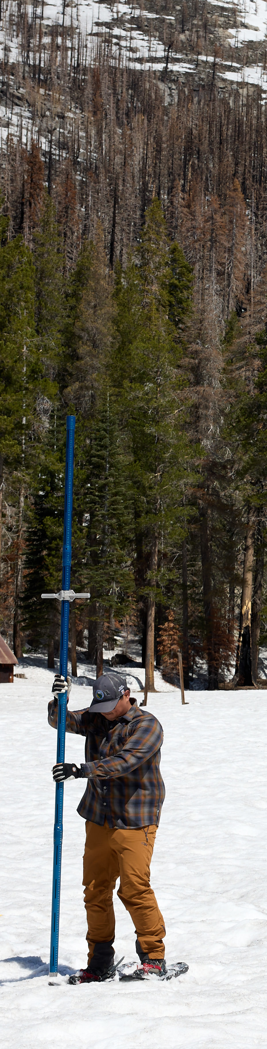
While technological advancements have been incorporated, CCSS relies on manual snow surveys as the foundation of its water supply forecasting system. These surveys involve the manual collection and analysis of snow samples at over 260 locations in California's snow accumulation zones. This data helps accurately correlate snow measurements with seasonal runoff, and it still involves surveyors trekking through snowy terrain, aided by field sensors and remote sensing techniques.
The data collected through these surveys are processed at the California Data Exchange Center (CDEC), where CCSS staff and partners use statistical analysis, numerical modeling, machine learning techniques, and physically-based models to generate short-term runoff forecasts and long-term seasonal water supply forecasts. Interactive data visualization dashboards and tools are increasingly utilized to enhance the accessibility, efficiency, and quality of forecasting products, demonstrating the program's adaptability for the benefit of California's water resource management and forecasting needs.